OC Birth Places of New Zealand Prime Ministers
Navigable waterways (canals, rivers, locks, lockless dams, shiplifts) of inland Europe (i.imgur.com)
Doughnut density of the US (i.imgur.com)
Global Offshore Wind Speeds (i.imgur.com)
An Incredibly Detailed Map of the World’s Religions (i.ibb.co)
Map of Italy in the year 1499, just before the Italian Wars (i.ibb.co)
Global annual coconut consumption in whole coconuts per capita (i.postimg.cc)
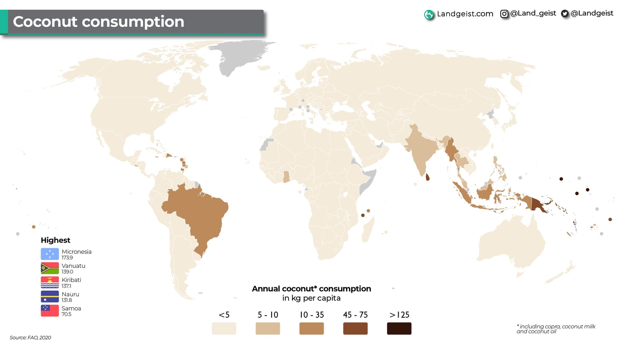
Okay, not coconuts, but kilograms per capita, but one coconut is about 1.4 kg. Close enough
A detailed shaded relief map of London rendered from Lidar data [work by u/visualgeomatics on reddit] (i.postimg.cc)
Source: England National Lidar Program...
Political map of contemporary Thuringia (Germany) in 1680
Africa's third longest river takes a crazy long route to get to the sea from its source in southern Guinea. (sopuli.xyz)
Population density of Africa (2022), credit to @milos_agathon on Twitter (sopuli.xyz)
The Khmer Empire around 900 AD (sopuli.xyz)
Countries whose militaries use Dolphins (sopuli.xyz)
Countries (plus Antarctica) where a mammal (excluding rodents) species outnumbers humans. (sopuli.xyz)
work of /u/Upstairs-Extension-9 on reddit
Map Showing the Extent of Earth’s Ice Cap During the Last Glacial Maximum 20,000 Years Ago (sopuli.xyz)
Neitokainen is a body of water in Finland, which is shaped like Finland (sopuli.xyz)
What year is it right now? (sopuli.xyz)
Countries where the Current Leader assumed Power by Coup d’ètat (sopuli.xyz)
Nuclear power plants in Europe as of 21.02.2023 [!] (sopuli.xyz)
1849 map of Scotland [6598 x 8922]
Source: catalogue.nla.gov.au/catalog/3622068
Wooden Map of Middle Earth
Made with a laser cutter and way too much time...