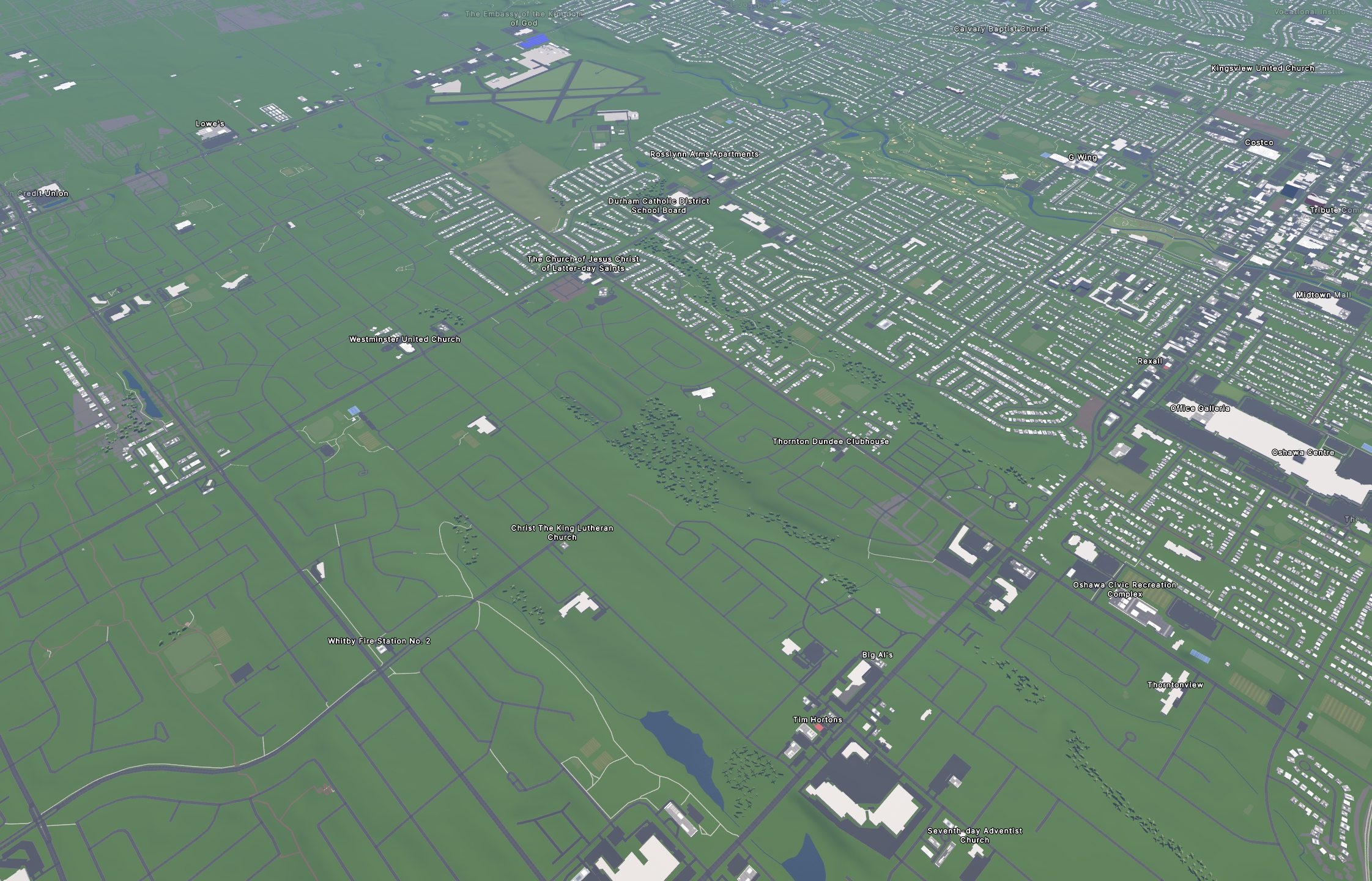
The left side is the next municipality over; I spent a month tracing all the buildings for the municipality on the right =)

I used streets.gl for the “Google Earth” view of the OSM data.

Much of the work was done with the help of rapideditor.org, although there was also a LOT of manual tracing and corrections along the way.

We have so much new development in the area that I had to rely on some pretty updated satellite images and local surveying to get most of that done (with more to be done in the future as several hundred more homes go up this year).

I used a combination of Bing, ESRI world imagery (the regular, not “clarity” beta), and Maxxar Premium imagery.

Totally worth it!

pgetsos,
pgetsos avatar

Have they added the ability to change the provider they use for their building recognition? I remember there was an open issue last time I checked

soyagi,

Good work! How does Rapid compare with iD, in your experience?

Showroom7561,

How does Rapid compare with iD, in your experience?

In the standard editior you have to find and then trace buildings by hand, which can can tedious and very time consuming. That’s what I was doing before someone told me about Rapid.

Rapid will highlight buildings that have yet to be mapped, and then you either approve or decline each one. Very few are perfect, so I do manually adjust the trace that Rapid provides, and sometimes it’s just plain off. Still much faster. The only issue it has is with new developments that aren’t on their map to be identified. Those I do nearly always by hand.

I’ve only used Rapid for buildings and not their other features.

flip,

Nice! Rapid is developed by Meta, are you granting them any rights of your work when you use it?

habi,

The traced buildings go to OSM. Meta uses OSM, but lots of other entities do, too. So, if I’m correct then Meta has no ‚rights‘ on your work, but uses it, as part of OSM.

Showroom7561,

Nice! Rapid is developed by Meta

Yeah, and I hate the fact that they actually made a good product out of 100 evil ones.

are you granting them any rights of your work when you use it?

No. They say that “All data provided through RapiD is open source under the MIT license.”, which is totally fine with me.

Their more detailed TOS doesn’t give me any pause for concern, either.

Same with the OSM terms, which basically say the data is open, provided you credit OSM when you use the data.

flip,

Thanks a bunch, will give it a spin then!

  • All
  • Subscribed
  • Moderated
  • Favorites
  • openstreetmap@lemmy.ml
  • DreamBathrooms
  • mdbf
  • ethstaker
  • magazineikmin
  • GTA5RPClips
  • rosin
  • thenastyranch
  • Youngstown
  • InstantRegret
  • slotface
  • osvaldo12
  • kavyap
  • khanakhh
  • Durango
  • megavids
  • everett
  • cisconetworking
  • normalnudes
  • tester
  • ngwrru68w68
  • cubers
  • modclub
  • tacticalgear
  • provamag3
  • Leos
  • anitta
  • JUstTest
  • lostlight
  • All magazines