@65dBnoise@mastodon.social
@65dBnoise@mastodon.social avatar

65dBnoise

@65dBnoise@mastodon.social

Electrical engineer
Marveling at the world

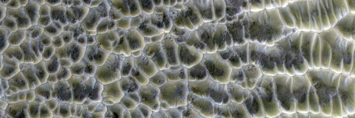
Lots of Martian rocks and landscapes, some looking all too familiar, but don't be fooled by that: Mars is an inhospitable toxic planet. Let's not mistake fiction for reality.

I like dirt and rocks, but I Am Not A Geologist (IANAG).

This profile is from a federated server and may be incomplete. Browse more on the original instance.

65dBnoise, to space
@65dBnoise@mastodon.social avatar

Until life (past or present (!)) is found on Mars, rocks is all we are gonna get 😀

The map shows rover location and FOV of camera.

Processed, cropped MCZ_RIGHT, FL: 110mm
Sol: 776, RMC: 39.0690, LMST: 11:06:12
Original: https://mars.nasa.gov/mars2020-raw-images/pub/ods/surface/sol/00776/ids/edr/browse/zcam/ZR0_0776_0735824272_113EBY_N0390690ZCAM08796_1100LMJ01.png
Credit: /JPL-Caltech/ASU/65dBnoise

image/jpeg

65dBnoise, to space
@65dBnoise@mastodon.social avatar

put its SHERLOC (WATSON not Holmes) to work, to examine a rock in its workspace. This is what it saw:

Sol: 776, RMC: 39.0690

Quickly processed, undistorted, rotated, cropped FRONT_HAZCAM_RIGHT
LMST: 12:15:59
Original: https://mars.nasa.gov/mars2020-raw-images/pub/ods/surface/sol/00776/ids/edr/browse/fcam/FRF_0776_0735828585_067ECM_N0390690FHAZ00206_01_295J01.png

Processed SHERLOC_WATSON
LMST: 12:13:02
Original: https://mars.nasa.gov/mars2020-raw-images/pub/ods/surface/sol/00776/ids/edr/browse/shrlc/SIF_0776_0735828400_253EBY_N0390690SRLC00701_0000LMJ01.png

Credit: /JPL-Caltech/65dBnoise

stim3on, to random
@stim3on@fosstodon.org avatar

Perseverance did a little routine check today to see whether her shadow is still there :)

Credit: NASA/JPL-Caltech/Simeon Schmauß

65dBnoise,
@65dBnoise@mastodon.social avatar

@stim3on
Very nice colors!

But no image details? 🤓

Landru79, to space Spanish
@Landru79@astrodon.social avatar

Creo que hay algo interesante en estas imágenes del cielo de

's rover
Left Navigation Camera (Navcam)

April 26, 2023 (Sol 775) 16:16:12. >> 16:19:02.

https://mars.nasa.gov/mars2020/multimedia/raw-images/NLG_0775_0735754619_792ECM_N0390690NCAM00518_00_2I3J

NASA/JPL-Caltech/j. Roger

video/mp4

65dBnoise,
@65dBnoise@mastodon.social avatar

@andrealuck @Landru79
Yes, both Deimos and Phobos were visible at that time (UTC: 2023-04-26T04:27:34) in that orientation. What we see is probably the larger of the two, Phobos, which was also higher up in the sky. The camera was looking at 30° elevation, 90° azimuth, and that's close to where Phobos was.

Says :

65dBnoise,
@65dBnoise@mastodon.social avatar

@Landru79
Maybe this is the first time Phobos is viewed in daylight from a rover on Mars? 👍 !

65dBnoise,
@65dBnoise@mastodon.social avatar

@Landru79 @TerraSabaea

Great memory @PaulHammond51 !
Then maybe, "the first time Phobos is viewed in broad daylight from a rover on Mars"? 😀 A few minutes before it took that image it had captured the sun:

MCZ_LEFT, FL: 110mm
Sol: 775, RMC: 39.0690, LMST: 16:12:25
Original: https://mars.nasa.gov/mars2020-raw-images/pub/ods/surface/sol/00775/ids/edr/browse/zcam/ZL7_0775_0735754365_928EBY_N0390690ZCAM01069_1100LMJ01.png
Credit: /JPL-Caltech/ASU/65dBnoise

65dBnoise,
@65dBnoise@mastodon.social avatar

@PaulHammond51 @Landru79 @TerraSabaea
Well, that's what deep human memory is built upon: feelings. In contrast to deep machine learning memory 😜

stim3on, to random
@stim3on@fosstodon.org avatar

Great news for anyone working with the Perseverance raw images!
A longstanding issue was recently fixed that applied a linear stretch to the public raw images.
This made it nearly impossible to work with the tiled Navcam images.
Comparison between Sol 501 and 770.

image/jpeg

65dBnoise,
@65dBnoise@mastodon.social avatar

@stim3on
I suspected something had happened because I no longer had to manually adjust the color of parts of my auto-mosaic images.

Your Twitter thread probably played a role, in which case it once again proves that takes user reports seriously.

Great job! 👍 !

65dBnoise,
@65dBnoise@mastodon.social avatar

@stim3on @kevinmgill
Which is why we love those people and the exemplary openness of NASA 😃

65dBnoise,
@65dBnoise@mastodon.social avatar

@stim3on
Thanks for the links!
Indeed, double posting there and here is a pain.

65dBnoise, to space
@65dBnoise@mastodon.social avatar

Fresh earthy colors, from Mars.

repositioned itself on Sol 775, maybe to operate on that rock at the center?

Quickly processed & 2:1 cropped mosaic of 4 FRONT_HAZCAM_RIGHT images
Sol: 775, RMC: 39.0668, LMST: 14:14:06
Original: https://mars.nasa.gov/mars2020-raw-images/pub/ods/surface/sol/00775/ids/edr/browse/fcam/FRF_0775_0735747092_784ECM_N0390668FHAZ01225_01_195J01.png
Credit: /JPL-Caltech/65dBnoise

slowe, to random
@slowe@mastodon.me.uk avatar

The other week I saw @65dBnoise's Mars Trilogy maps https://mastodon.social/@65dBnoise/109849270626537378 via @elakdawalla. I've adapted them into an interactive, zoomable, map as an illustrative example for a visualisation package we are making for work: https://open-innovations.github.io/oi-lume-charts/samples/map/zoomable/#example-9 The zoomable map makes use of OpenPlanetary's nice base map tiles.

65dBnoise,
@65dBnoise@mastodon.social avatar

@slowe Cool! 👍 !
(for some reason I get an error when I try to boost this post)

65dBnoise, (edited ) to space
@65dBnoise@mastodon.social avatar

It turns out the flew a complex flight path (re: https://mastodon.social/@65dBnoise/110249309884223213).

The map shows the official flight path and an estimated location and field-of-view (cyan) of the RTE 51-7 image posted earlier.

EDIT: The flight path may be an indication of the path may follow when it departs Mount Julian, as the almost flat top of that hill appears to be smoother than other path choices.

65dBnoise,
@65dBnoise@mastodon.social avatar

@stim3on
😍 !

65dBnoise, (edited ) to space
@65dBnoise@mastodon.social avatar

An instance of robotic life on Mars. (up left corner, animated zoom) and Belva Crater, seen by during . The tracks the rover made a few sols ago can be seen crossing from right to left near 1/3 from the top.

Animated zoom, processed, undistorted, rotated HELI_RTE
Flight: 51
Sol: 772, LMST: 15:23:04
Original: https://mars.nasa.gov/mars2020-raw-images/pub/ods/surface/sol/00772/ids/edr/browse/heli/HSF_0772_0735485020_529ECM_N0510001HELI00007_000085J01.png
Credit: /JPL-Caltech/65dBnoise

65dBnoise,
@65dBnoise@mastodon.social avatar

@jpm2141
There may be more like those coming 🙂

65dBnoise, to space
@65dBnoise@mastodon.social avatar

(up left corner) and Belva Crater, seen by during .

Quick processed, unistorted, rotated HELI_RTE
Flight: 51
Sol: 772, LMST: 15:23:04
Original: https://mars.nasa.gov/mars2020-raw-images/pub/ods/surface/sol/00772/ids/edr/browse/heli/HSF_0772_0735485020_529ECM_N0510001HELI00007_000085J01.png
Credit: /JPL-Caltech/65dBnoise

65dBnoise,
@65dBnoise@mastodon.social avatar

@sharponlooker @stim3on
👍 ! This must be the best photo of the mission! (so far)

65dBnoise,
@65dBnoise@mastodon.social avatar

@tom30519 @stim3on

Now, you AI people, give it your best! 😍

65dBnoise,
@65dBnoise@mastodon.social avatar

@tom30519
Belva is the footprint of a goddess that came from the sky, so age is not a thing for a heavenly creation 😀

65dBnoise,
@65dBnoise@mastodon.social avatar

@kevinmgill @stim3on
Ain't she a beauty?!

65dBnoise, (edited ) to space
@65dBnoise@mastodon.social avatar

Inverted perspective.
An optical illusion.

Belva Crater, Jezero, Mars

Quickly processed, the sky would indeed be up, if visible 🙂
MCZ_RIGHT, FL: 110mm
Sol: 772, RMC: 39.0650, LMST: 15:41:14
Original: https://mars.nasa.gov/mars2020-raw-images/pub/ods/surface/sol/00772/ids/edr/browse/zcam/ZR0_0772_0735486130_193EBY_N0390650ZCAM08789_1100LMJ01.png
Credit: /JPL-Caltech/ASU/65dBnoise

65dBnoise, to space
@65dBnoise@mastodon.social avatar

Angled rocks on the nearby interior wall of crater Belva.

The rock on top left appears to be about 70m away. Context map follows.

Processed MCZ_RIGHT, FL: 110mm
Sol: 772, RMC: 39.0650, LMST: 15:39:43
Original: https://mars.nasa.gov/mars2020-raw-images/pub/ods/surface/sol/00772/ids/edr/browse/zcam/ZR0_0772_0735486032_193EBY_N0390650ZCAM08789_1100LMJ01.png
Credit: /JPL-Caltech/ASU/65dBnoise

65dBnoise,
@65dBnoise@mastodon.social avatar

Context map for the image above. The jagged edges show the limits of the DTM resolution.

Map made with and 's data, using DTMs

65dBnoise, (edited ) to space
@65dBnoise@mastodon.social avatar

Anyone reading Kim Stanley Robinson's "Mars Trilogy" or any part of it quickly realizes that while the novels are full of technical details, there are very few maps and those that exist are very coarse.

Here are some maps I made while reading the books several years ago, showing cities, places and plot info. The background is a USGS Topographical Map from Wikipedia: https://upload.wikimedia.org/wikipedia/commons/4/48/USGS-PlanetMars-TopographicalMap.png

Corrections and new locations will be posted to this thread.

65dBnoise,
@65dBnoise@mastodon.social avatar

@tom30519
The "Fi" part wins, that is 😀

  • All
  • Subscribed
  • Moderated
  • Favorites
  • JUstTest
  • GTA5RPClips
  • DreamBathrooms
  • cubers
  • mdbf
  • everett
  • magazineikmin
  • Durango
  • Youngstown
  • rosin
  • slotface
  • modclub
  • kavyap
  • ethstaker
  • megavids
  • ngwrru68w68
  • thenastyranch
  • cisconetworking
  • khanakhh
  • osvaldo12
  • InstantRegret
  • Leos
  • tester
  • tacticalgear
  • normalnudes
  • provamag3
  • anitta
  • lostlight
  • All magazines