@mappingsupport@m.ai6yr.org
@mappingsupport@m.ai6yr.org avatar

mappingsupport

@mappingsupport@m.ai6yr.org

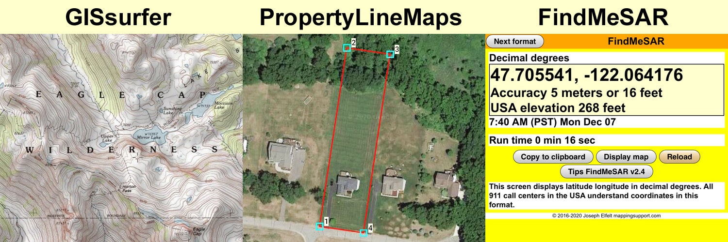
Developer of #GISsurfer web map using the #Leaflet map API.

Developer of #GeoJPG web app. Offline maps with NO ads, NO tracking, NO signup and NO fees. #PWA

Developer of #FindMeSAR web app. #PWA

Curator of 3,000+ #ArcGIS server list.

Consultant producing property line maps to help you find lost survey stakes.

Lives in #PNW.

This profile is from a federated server and may be incomplete. Browse more on the original instance.

mappingsupport, to pnw
@mappingsupport@m.ai6yr.org avatar

1/_ 🧵 Many counties (including mine - King County WA) use the CodeRed system for alerting people about a wildfire evacuation. Recently I traded email with county staff and got some details about how this works.

If your county’s emergency management web page shows they use CodeRed then there should be a signup link. When you signup, enter your address or use the map by dragging the marker, zooming in and repeating until the marker is where you live.

If my area is ordered to evacuate then I want to get that message by every means possible. We have a landline so I entered our “Home phone” number, my cell number and my main email address that I check the most often.

  • All
  • Subscribed
  • Moderated
  • Favorites
  • anitta
  • rosin
  • InstantRegret
  • ethstaker
  • DreamBathrooms
  • mdbf
  • magazineikmin
  • thenastyranch
  • Youngstown
  • GTA5RPClips
  • slotface
  • Durango
  • khanakhh
  • kavyap
  • megavids
  • everett
  • vwfavf
  • Leos
  • osvaldo12
  • cisconetworking
  • cubers
  • modclub
  • ngwrru68w68
  • tacticalgear
  • provamag3
  • normalnudes
  • tester
  • JUstTest
  • All magazines