[SOLVED] How would you tag this? (lemdro.id)
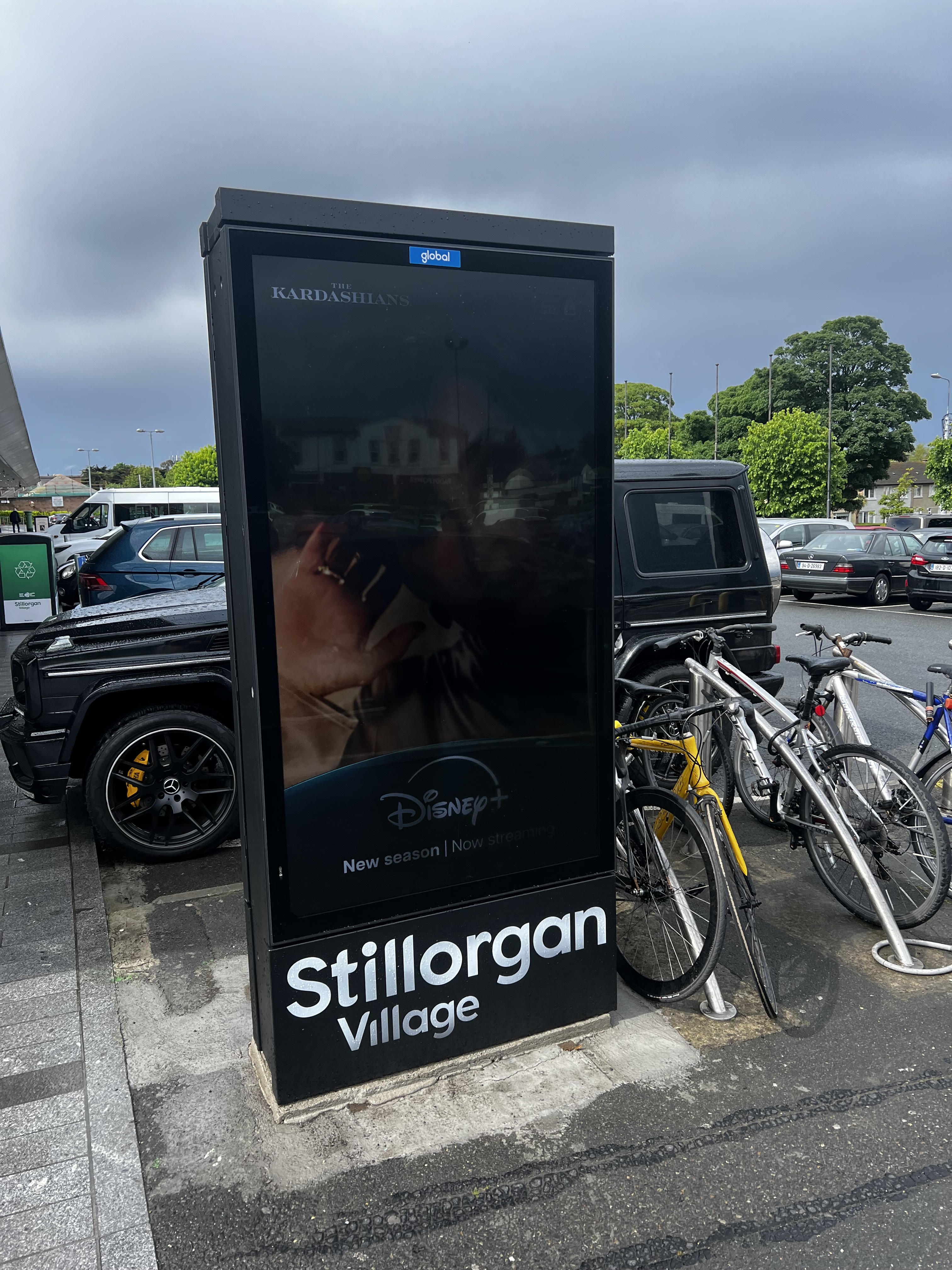
I’m referring to the advertising/digital display. I thought of using man_made=advertising + advertising=* but not of the examples on the wiki seemed to match very well....
This magazine is from a federated server and may be incomplete. Browse more on the original instance.
I’m referring to the advertising/digital display. I thought of using man_made=advertising + advertising=* but not of the examples on the wiki seemed to match very well....
Edit: the problem is gone, i assume it was a buggy track. The problem exists with the versio 4.7.10, from 24.04.24, which is the version that is recommended by fdroid. It is gone in the latest one from 14.05.24...

People are editing OSM to be able to get their Pokémon and others are changing OSM to mess with people so they can’t get them

Recently the city redesigned the street and prepared at least 4 bus stops. The stops all have the road markings and tactile paving, etc. but no bus stop signs yet and currently no line stops there. (There is an ongoing reorganization of bus lines in my area.)...
I have a solar array on my roof. If I find my house in OSM, there’s a lightning bolt icon indicating there’s a solar array present. Not only that, but the exact layout of the panels in my roof is shown. I never submitted this info to anyone, Google Maps Satellite view doesn’t show them. I’m really curious where OSM got...

Overpass Query:...

StreetComplete is an easy to use editor of OpenStreetMap data available for Android. It can be used without any OpenStreetMap-specific knowledge. It asks simple questions, with answers directly used to edit and improve OpenStreetMap data. The app is aimed at users who do not know anything about OSM tagging schemes but still want...

To connect simply run:...

I wonder how many I have already mapped.
Pretty cool idea by using open street maps you can download the location you want and play the game there, defend your neighborhood or loot your house....

2004: OpenStreetMap is founded because Ordnance Survey won’t make their data open...
Convert your OpenStreetMap-based application links into Google Maps, Apple Maps or other links (and vice versa) without having to use proprietary software!...

I thought I’d share this Mastodon bot - @SmallTownUSA - here as I’ve found it great fun....
I’ve found that I still record a lot of data while hiking. Trail surfaces, POIs, you name it. However I find less and less time to turn these datasets into actual map data. I can’t be the only one that this happens to. Is there some kind of service that connects people that collect data and armchair mappers?
I would like to use openstreetmap as replacement for google maps (on web) However default nominatim doesn’t generally give correct address (when searched for POI). Is there way to change nominatim provider?
Organic Maps is available on Linux! It’s on flatpak and several package repos (but not apt). I don’t know how long it’s been there — I just discovered it....

Where is it coming from? Are there other open sources of map data?...
wiki.aaroads.com

I live in an area where tons of data is missing. I mean the whole areas with no street addresses, missing streets, missing bike routes, etc....