@PaulHammond51@fosstodon.org
@PaulHammond51@fosstodon.org avatar

PaulHammond51

@PaulHammond51@fosstodon.org

Following MSL & M2020 on Mars.

This profile is from a federated server and may be incomplete. Browse more on the original instance.

sharponlooker, to random
@sharponlooker@mastodon.social avatar
PaulHammond51,
@PaulHammond51@fosstodon.org avatar

@sharponlooker

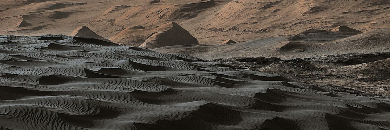
I remember Lori writing to me regarding an image I posted in the early days of MSL... 'Curiosity Rover Cresting a Dune'.

I've called them ripples ever since LOL

65dBnoise, to space
@65dBnoise@mastodon.social avatar

New site number 52 for on Sol 1129, but apparently at the same location. The rover appears to be stuck in a sand field, although that may not be the reason for its recent inactivity.

Processed, leveled NAVCAM_LEFT mosaic
looking SE (126°) from RMC 52.0000
Sol 1129, LMST: 14:53:23

Original: https://mars.nasa.gov/mars2020-raw-images/pub/ods/surface/sol/01129/ids/edr/browse/ncam/NLF_1129_0767175699_410ECM_N0520000NCAM02129_02_095J01.png
Credit: /JPL-Caltech/65dBnoise

PaulHammond51,
@PaulHammond51@fosstodon.org avatar

@stim3on @65dBnoise Ditto 😬

PaulHammond51, to random
@PaulHammond51@fosstodon.org avatar

@65dBnoise

Deep into image withdrawal symptoms... 🙃

Rover Issues?
Software update?
DSN issues?
Bug?
None of the above?

PaulHammond51,
@PaulHammond51@fosstodon.org avatar

@65dBnoise I'd have to agree re abandoning Bright Angel unless they can spot a very safe path a little further to the West. Loose sands are not happy places for Mars rovers or their drivers.

65dBnoise, to space
@65dBnoise@mastodon.social avatar

appears to have some hard time passing through sand and rocks lying in front of it on its westward venture.

Map made with using data from 's system, and imagery, and @PaulHammond51 image from here: https://mastodon.social/@PaulHammond51@fosstodon.org/112295218935277266

image/jpeg

PaulHammond51,
@PaulHammond51@fosstodon.org avatar

@65dBnoise Just checked the official map, Sadly the path for 1124 is still not shown, so I'm happy that you can produce these from the raw data :)

PaulHammond51,
@PaulHammond51@fosstodon.org avatar

@65dBnoise

I realise the 1124 drive may have completed when the mapping staff at JPL were not on shift, that and it's only 12 hours since I posted that image, so I guess we may see the map updated soon as the staff return to work :)

PaulHammond51,
@PaulHammond51@fosstodon.org avatar

@65dBnoise Agreed... It's a beacon shining very brightly in a presently dark place. Their new web format is still causing issues with some stuff gone AWOL, but that should be resolved soon enough (fingers crossed)

PaulHammond51,
@PaulHammond51@fosstodon.org avatar

@65dBnoise The MSL post-drive R-NavCam mosaics. Some of the earlier ones have made it to this new page, but there all the recent ones are missing. These were produced and issued hours after each drive, sometimes several versions as additional images were downlinked from the rover... I miss those... Probably many more pages, but of those that I don't visit on a daily basis
https://science.nasa.gov/mars/resources/

PaulHammond51,
@PaulHammond51@fosstodon.org avatar

@65dBnoise There's an odd issue with the MSL raw page. Some NavCam images are not shown, but they are downloadable and can be opened if you know the URL, but they are not shown on the raw page. This is happening on stereo NavCam pairs where the server shows only say the L-NavCam, but not the R-NavCam...

You can adjust the URL to open the stereo image you need, or you can use the JSON manifest to locate and obtain its URL

https://msl-raws.s3.amazonaws.com/images/image_manifest.json

PaulHammond51,
@PaulHammond51@fosstodon.org avatar

@65dBnoise If your LA is searching from the JSON manifest, then it looks like you are golden. If it's searching from the MSL raw image server you may be missing an image or two until the raw server catches up with the manifest. I have seen instances in the past where the MSL server was frozen for a day or so, and not updating, but the manifest had been spot on, so it is a great 'Plan B' to have

PaulHammond51,
@PaulHammond51@fosstodon.org avatar

@65dBnoise then you're good :)

PaulHammond51, to space
@PaulHammond51@fosstodon.org avatar

Drive on Sol 1124 to site 51.5030. Looks like a nice location for SuperCam to take a peep at the west side of the ripple where Ingenuity is collecting data.

PaulHammond51, to random
@PaulHammond51@fosstodon.org avatar

@65dBnoise

Any idea where JPL have moved the Mars mission maps to? The old URL for M20 and MSL are broken. They have just reformatted a number of mission pages (raw images, home pages etc), but I cant find the new URLs for the maps...

PaulHammond51,
@PaulHammond51@fosstodon.org avatar

@AkaSci @65dBnoise

I wish they would leave active missions alone when they want a new web format, save that sort of stuff for new missions...

PaulHammond51,
@PaulHammond51@fosstodon.org avatar

@65dBnoise Thanks. Before the old url took me to a search page. I'm on the road at the moment, but I don't think I'll be accepting any cookies to use the map when I get home.

PaulHammond51,
@PaulHammond51@fosstodon.org avatar

@65dBnoise yup, not an option for me.

PaulHammond51,
@PaulHammond51@fosstodon.org avatar

@65dBnoise

The maps are back, same URLs and no visible request for cookies :)

pomarede, to Kurzgesagt
@pomarede@mastodon.social avatar

wow what a fascinating Martian sight, wish there were a dual stereo pair of images to see this one in 3D!

This image was taken by the Left Navigation Camera onboard NASA's Mars rover Curiosity on Sol 4155 (2024-04-14).

Credits: NASA/JPL-Caltech

https://mars.nasa.gov/raw_images/1320755/

PaulHammond51,
@PaulHammond51@fosstodon.org avatar
PaulHammond51,
@PaulHammond51@fosstodon.org avatar

@pomarede The raw images page has occasional issues. They had published the R-NavCam mosaic earlier today that included the frame you were seeking, but the image was somehow not shown on the raw image server. So I just waited for the server to update and found it. Here is the R-NavCam mosaic issued by JPL, it is assembled from 31 frames: https://mars.nasa.gov/system/resources/deepzooms/27979_N_R000_4155_EDR106CYLASB2386_AUTOLM2.PNG

PaulHammond51,
@PaulHammond51@fosstodon.org avatar

@pomarede The terrain in this part of the notional traverse is providing some lovely opportunities for 3D imaging.

PaulHammond51, (edited )
@PaulHammond51@fosstodon.org avatar

@pomarede Way back before launch JPL were reviewing the various candidate landing sites for MSL they had a series of workshops, some of those were shared with the public. I remember well the MSL Gale crater workshop and a few of the locations that it would potentially visit. The Gediz Vallis Channel (where the rover is now) has been high on my wish list since those pre-launch days, and here we are now. Here is a the map (three views) of the 4152 location before the 22.4 meter drive on 4155.

65dBnoise, to space
@65dBnoise@mastodon.social avatar

Closeup view of the SUPERCAM microphone, located at the masthead and seen here by the SHERLOC_WATSON camera, located at the end of 's robotic arm.

Looking WNW (287°) from RMC 51.4014
Sol 1119, LMST: 12:55:18

Original: https://mars.nasa.gov/mars2020-raw-images/pub/ods/surface/sol/01119/ids/edr/browse/shrlc/SIF_1119_0766280670_277EBY_N0514014SRLC07030_0000LMJ01.png
Credit: /JPL-Caltech/65dBnoise

PaulHammond51,
@PaulHammond51@fosstodon.org avatar

@65dBnoise I hope that's just a routine investigation for dust etc, and there's not an issue with the microphone.

I did not realise if was a COTS item :)

65dBnoise, to space
@65dBnoise@mastodon.social avatar

On Sol 1115 moved yet again to a new location, RMC 51.3152, 50m down the predicted path, and stopped again at the middle of a regolith ripple. It's now ~400m S of which is hidden from view. No SUPERCAM image of the has been downlinked yet.

Processed, undistorted, leveled NAVCAM_RIGHT mosaic
looking NNW (327°) from RMC 51.3152
Sol 1115, LMST: 13:11:43

Original: https://mars.nasa.gov/mars2020-raw-images/pub/ods/surface/sol/01115/ids/edr/browse/ncam/NRF_1115_0765926588_659ECM_N0513152NCAM03115_04_195J01.png
Credit: /JPL-Caltech/65dBnoise

image/jpeg
image/jpeg

PaulHammond51,
@PaulHammond51@fosstodon.org avatar

@65dBnoise
The M20-JSON (URL) & the GeoJSON (Map) are currently reporting the sol 1115 drive distance as zero. However, the track on the interactive mission map reports the distance as 51.13 meters :)

PaulHammond51, (edited )
@PaulHammond51@fosstodon.org avatar

@65dBnoise

Same series, but I import the data into my spreadsheet from the 'waypoints' URL It provides extra details that I use, including "dist_m" :)

https://mars.nasa.gov/mmgis-maps/M20/Layers/json/M20_waypoints.json

PaulHammond51,
@PaulHammond51@fosstodon.org avatar

@65dBnoise The waypoints URL now shows the correct 'dist_m' value for the sol 1115 drive :)

  • All
  • Subscribed
  • Moderated
  • Favorites
  • anitta
  • kavyap
  • DreamBathrooms
  • InstantRegret
  • magazineikmin
  • Durango
  • GTA5RPClips
  • thenastyranch
  • Youngstown
  • rosin
  • slotface
  • khanakhh
  • osvaldo12
  • tacticalgear
  • JUstTest
  • cubers
  • everett
  • Leos
  • tester
  • mdbf
  • ngwrru68w68
  • ethstaker
  • modclub
  • megavids
  • provamag3
  • cisconetworking
  • normalnudes
  • lostlight
  • All magazines