Dragonlance

az,
@az@betagravity.com avatar

Either I missed it in school or forgot about it, but TIL about the Province of Quebec that for a brief time extended to the Mississippi and Ohio rivers

https://en.wikipedia.org/wiki/Province_of_Quebec_(1763%E2%80%931791)

#map #history

byteseu,
@byteseu@pubeurope.com avatar

Chinese Debts in Africa [Millions of USD] https://www.byteseu.com/144211/

joachim,
@joachim@drupal.community avatar

@openstreetmap Something really needs to be done about the 'Transport map' layer, because this is absolutely NOT a usable transport map: https://www.openstreetmap.org/#map=15/50.8451/4.3570&layers=T

joachim,
@joachim@drupal.community avatar

@ekes That rendering was available as a layer on the OSM site for a while, and then removed. No idea why! It's definitely better, though the shades of blue for tram and metro are far too alike.

ekes,
@ekes@drupal.community avatar

@joachim I looked at the wiki afterwards. I'm assuming it's not getting updated often enough: https://wiki.openstreetmap.org/wiki/Featured_tile_layers

daniel_bohrer,
@daniel_bohrer@chaos.social avatar

TIL: there is a small Switzerland in the middle of Switzerland
https://www.openstreetmap.org/#map=19/46.79850/8.23179

daniel_bohrer,
@daniel_bohrer@chaos.social avatar

TIL2: The center of Appenzell-Ausserrhoden has no marker on the ground because it lies in the canton Appenzell-Innerrhoden.
https://de.wikipedia.org/wiki/Mittelpunkt_des_Kantons_Appenzell_Ausserrhoden

Vivaldi, (edited )
@Vivaldi@vivaldi.net avatar

If you’ve been following us, you’ll know that we’re big on the Fediverse.

It was incredibly important for us to create an instance and provide everyone with a social network free of ads and algorithms.

Join us live this Saturday as we talk about why it was important for us to do more than just be around here.

We’ll be joined by @beardedtechguy and @cliffwade from @AllThingsTech, who will also talk about the Fediverse and why it matters to them.

🎧 Join the audio event here: https://audon.space/u/@Vivaldi@social.vivaldi.net

SigurdVie,
@SigurdVie@mastodon.world avatar

@Vivaldi @AllThingsTech @cliffwade @beardedtechguy oooh! Can't wait! Gonna have to make room for this on my calendar... 😅 I've invited the folks at fedihosting.foundation to listen along aswell!

Vivaldi,
@Vivaldi@vivaldi.net avatar
silmathoron,
@silmathoron@floss.social avatar

Anyone knows a music player on Linux than supports the format?
Preferably a @kde styled one but I'll take others.

As far as I can tell, and do not seem to support it (please let me know if that's wrong since I'd rather use one of these two).

I've seen that VLC reads it but I don't find it very satisfying as a music player.

xylophilist,
@xylophilist@mastodon.online avatar

Ya beauty! Three clear overhead flash+BOOOOM thundercracks and counting.
And the rain is most definitely on.

Not to mention, I was just back from walking 🐕‍🦺when it all started. Fortunate timing.

Gotta love a decent thunderstom. ⛈️⛈️⛈️

#thunderstorm #lightning #map #scotland #perthshire #delight #BiggerBadderBOOM

image/png

xylophilist,
@xylophilist@mastodon.online avatar

@felicitymartin Can believe it. If you're where I suspect you are, it might well be on its way :)

felicitymartin,
@felicitymartin@mastodon.scot avatar

@xylophilist I hope it’s less destructive than the one on Saturday night, which knocked out broadband across our whole village for 24 hours.

queer_cycling_berlin, German
@queer_cycling_berlin@lsbt.me avatar
kgjenkins,
@kgjenkins@mapstodon.space avatar

Good luck getting out of this place alive
https://www.openstreetmap.org/#map=17/40.97855/-76.60350

moodeaudio,
@moodeaudio@fosstodon.org avatar

Hi, moOde 9.0.0 is available in the Media Player OS section of the Raspberry Pi Imager or as a direct download at https://moodeaudio.org. Visit the Forum for more information https://moodeaudio.org/forum/showthread.php?tid=6484&pid=54308#pid54308

Zenek73, Polish
@Zenek73@101010.pl avatar
TerribleMaps,
@TerribleMaps@en.osm.town avatar

#Map shows Europe is divided into 4 regions based on origins of the word #beer. Source: buff.ly/3JTk43k

lanodan,
@lanodan@queer.hacktivis.me avatar

@chjara @TerribleMaps tfw I was too young to drink beer when I went to Scotland.

HirschKauz,
@HirschKauz@en.osm.town avatar

@TerribleMaps
Happy to see my little country on this map - but tell me, is the color of Italy correct? ;-)

researchbuzz,
@researchbuzz@researchbuzz.masto.host avatar

'Winamp has announced that on 24 September 2024, the application's source code will be open to developers worldwide.

Winamp will open up its code for the player used on Windows, enabling the entire community to participate in its development. This is an invitation to global collaboration, where developers worldwide can contribute their expertise, ideas, and passion to help this iconic software evolve.'

https://about.winamp.com/press/article/winamp-open-source-code

shaft, (edited ) French
@shaft@piaille.fr avatar

J'ai découvert hier que le bâtiment à l'angle de la rue des Bretons et l'avenue du Président Wilson à Saint-Denis abrite le "Celebrity Center du Grand Paris" de l'église de Scientologie.

Ça doit être récent vu que je passe là tous les jours et c'est la 1ère fois que je le remarque

Si je croise Tom Cruise, je lui pète la gueule (du haut de mes 1m70, je doit faire une tête de plus que lui)

https://www.openstreetmap.org/#map=18/48.92028/2.35819

Edit : C'est leur cousin de l'« Église de Scientology » en fait. (Le fameux cousin très ressemblant mais avec une moustache et des lunettes). Il y a aussi 2 grands panneaux « Scientology » en haut de deux côtés du bâtiment

gub,
@gub@framapiaf.org avatar

@shaft ah ouais je connais. Scientology ils font des NAS.

shaft,
@shaft@piaille.fr avatar
audiomo,
@audiomo@vivaldi.net avatar

A federated recording app / platform would be a cool thing. Like a federated version of now that would be great for

miketheman,
@miketheman@hachyderm.io avatar

Are you coming to US this week in Pittsburgh? I am!

I put together a helpful custom 📍 with the recommended local places from the PyCon US website to help me navigate - hope it helps you too in some way.

https://www.google.com/maps/d/viewer?mid=1Y31kfV0PKgUNNkjlx_JujwL_w5LvV5Y&ll=40.46084522106604%2C-79.9658134&z=13&hl=en

hugovk,
@hugovk@mastodon.social avatar

@miketheman Thanks for this! Two things:
Reocmmendations typo in title.
You can remove Dave and Andy's Homemade Ice Cream.

MiMar, German

Moin
sind gerade auf der Insel Amrum
und ein Teil bei sieht irgendwie nicht richtig aus..
Bin etwas ratlos was passiert ist 😟 , kann jemand helfen?

Ich meine diese ganzen Linien hier...
https://www.openstreetmap.org/#map=15/54.6655/8.3188&layers=G

wuffel, German

Huhu!
👋 von der
https://www.kulturelle-landpartie.de/

Super Wetter, tolle Leute überall, und heute Abend gibts virtuosen modernen Tanzlärm mit den "Analogue Birds" in Sallahn

https://www.openstreetmap.org/#map=18/53.02512/10.99952

Hey, das ist fast so cool wie das vom 16. bis 21. Juli, für das ihr euch ja wohl inzwischen angemeldet habt ...OOOODER? Das ist auch hier in der Gegend. Perfekt für nen dynamischen Urlaub!
👉 F e d i c a m p 2024 👈
https://fedi.camp

@fedicamp

BrauchC,

@wuffel @fedicamp damit hatte ich jetzt nicht gerechnet, danke 🤩

mocksita,
@mocksita@social.tchncs.de avatar

@wuffel @fedicamp
Danke für den tollen Tipp, ab morgen werde ich mich auch auf der tummeln - und mir schon mal den Platz fürs anschauen - Vielleicht treffen wir uns diesmal am analogen Fedilagerfeuer...

metin,
@metin@graphics.social avatar

Get a first taste of what will probably become the next level 3D maps / street view, using Gaussian Splatting to map environments in 3D.

In this demo, the detail level gets crude when zooming in, but that will become refined.

Use mouse-buttons to zoom, pan or rotate…

https://maps-and-splats.glitch.me

#map #maps #3D
#cartography #topography #world #WorldMap #cities #landscape #environment #data #tools #science #IT #graphics

JetlagJen,
@JetlagJen@geekdom.social avatar

What can I use to make a simple from a list of coordinates?

I have a world that I've been working on for a while. I've built a network of secured routes between nether portals and I'd like to make a sort of tube map of them. I've done it on paper previously, but I don't want to redraw the whole thing every time it outgrows the page.

It doesn't need to be fancy or pretty. I just want to stick the place names and coordinates in and get a plot / chart / map out for reference.

JetlagJen,
@JetlagJen@geekdom.social avatar

@RPBook only if the spreadsheet program can plot against a proper scaled X axis. It's been a while since I tried, but last time I did, that wasn't a thing. It expected the X data to be evenly spaced, eg like every year through a period.

RPBook,
@RPBook@historians.social avatar

@JetlagJen ah, OK.

ilanthar, French

Toujours en train de placer les noms sur la carte du monde d'Eldoran...
En attendant, sachez qu'Eldoran possède trois lunes et tourne autour de 2 étoiles.

Still placing names on Eldoran world map...
Meanwhile, you can see that Eldoran has three moons & evolves around 2 stars.
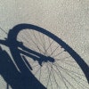

Vue d'Eldoran (sur la droite) et des ses satellites, comprenant la lune Séléné et ses "filles", deux autres lunes tournant autour d'elle, la rouge Cybèle et la turquoise Ipocrène (dont la révolution est polaire).

alex, French
@alex@social.nah.re avatar

Passage à sur la structurante Ludres-Nancy. L'intersection entre le parc des expos, la D674, France 3 Lorraine et l'ancien bâtiment Boulanger est une onde rouge. 6 feux, tous aux rouge.

https://www.openstreetmap.org/#map=17/48.66924/6.18999&layers=Y

Attendre le premier feu au vert.
Traverser une section.
Feu rouge. Attendre qu'il passe au vert.
Traverser une section.
Feu rouge. Attendre qu'il passe au vert.
Traverser une section.
Feu rouge. Attendre qu'il passe au vert.
Traverser une section.
Feu rouge. Attendre qu'il passe au vert.
Traverser une section.
Feu rouge. Attendre qu'il passe au vert.
Continuer sur la structurante (enfin, juste un coup de peinture sur le trottoir) qui est pas entretenu (arbres et plantes sur le mur, trottoir complètement défoncé), et qui longe le cimetière du sud.

byteseu,
@byteseu@pubeurope.com avatar
Vivaldi,
@Vivaldi@vivaldi.net avatar

🎙️ We kicked off the first Live audio Community Talk with our cherished Community members recently.

🎧 In case you missed it, grab your beverage, kick back, and listen as Vivaldi hosts @marialeal and @devina, talk to them about "What makes Vivaldi unique?" 👇🏻

https://community.vivaldi.net/vivaldi-community-talks/

erilun06,
@erilun06@vivaldi.net avatar

@Vivaldi @marialeal @devina
When is the next one?

ChristopheLeBas, French

👀 Today, i tried something special : playing with lidar datas from IGN (Institut national de l'information géographique et forestière) 🎚️

First of all, you can see here a standard lidar file. Nice and creepy ^^ 😨

ChristopheLeBas,

With QGIS, we can create a 3D view, and a video. You have it here. 🎥

There's 600 images generatded by QGIS then assembled with GIMP. Quite... hardtime again.

I don't know why i have map 3d map, and a second map just in the back. If someone can help :)
#maps #mapping #map #gif #qgis #lidar #data

A gif of the colorizer lidar point thanks to cloucompare

vpicavet,
@vpicavet@mastodon.social avatar

@ChristopheLeBas The second one is the 2D layer corresponding to your LIDAR data. QGIS displays all 2D layers by default, in a 3D view. Without any elevation it is at elevation 0, so below your 3D data. You can disable the 2D layer, or specify a DEM to use as elevation so that the 2D layer will be projected onto the DEM, theoritically at the same place as the PointCloud data.

  • All
  • Subscribed
  • Moderated
  • Favorites
  • Dragonlance
  • khanakhh
  • magazineikmin
  • mdbf
  • GTA5RPClips
  • everett
  • rosin
  • Youngstown
  • tacticalgear
  • slotface
  • ngwrru68w68
  • kavyap
  • DreamBathrooms
  • thenastyranch
  • tester
  • JUstTest
  • ethstaker
  • cubers
  • osvaldo12
  • cisconetworking
  • Durango
  • InstantRegret
  • normalnudes
  • Leos
  • modclub
  • anitta
  • provamag3
  • megavids
  • lostlight
  • All magazines